Discover an ever-changing landscape with panoramic views and a wealth of wildlife, at this most southerly point on the Isle of Wight. See the island’s only surviving onshore lighthouse and explore the area where Marconi made some of his early experiments in radio.
This is a circular walk with six gates, one stile and well over a hundred steps. It is a challenging walk for all abilities.
The nearest toilet and cafe are in Niton village. On route you will pass the Buddle Smugglers Inn where you can buy food and drinks.
THIS IS A NATIONAL TRUST WALK. PLEASE CONSIDER SUPPORTING THIS IMPORTANT CHARITY BY BECOMING A MEMBER, OR BY MAKING A DONATION.
- Address: National Trust car park, cul-de-sac at end of Sandrock Road, near St Catherine's lighthouse off the A3055 in Niton Undercliff. Nearest postcode PO38 2NP.
- OS map: Landranger 196, Explorer OL29
- Activity: Walking
- Challenging: Hilly, grassy terrain with many steps.
- Dog friendly: Dogs are welcome but please keep them on a lead around wildlife and livestock, and take any dog waste home with you.
- Full trail: Miles: (km)
- Access: Moderate
- Duration: 2 hours - 2 hours 30 mins
- Total ascent: 180m (600ft)
You can view a PDF of this walk by clicking the button below, but it lacks some of the extra information. So read below for further details which is taken from the National Trust website.
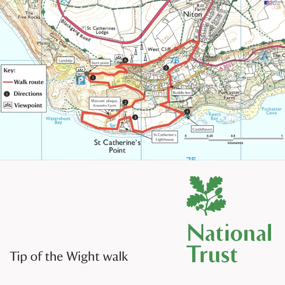
Start Point
Car park at end of Old Blackgang Road, Niton Undercliff, grid ref: SZ494758
Step 1
From the car park, go through the furthest kissing gate and turn left along a grassy track, keeping level and then bear right down into a dip. Turn left and follow the path through the valley, bear right and gently uphill at the fork. At a path junction, turn left parallel to the coast. Keep to the right of the large rock and eventually drop down to a road and go through a kissing gate. Turn right and head downhill.
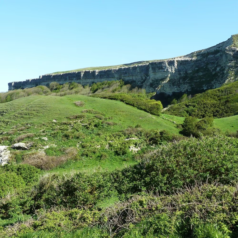
LOOK OUT FOR: The Undercliff
This large area of coastal landslips was formed over many hundreds of years. The benefits of such an active landscape include bare ground and temporary pools for insects and amphibians. The fact that it is ever-changing means that varied scrubby vegetation is created, providing a good habitat for migrating and breeding birds, such as chiffchaffs and other warblers. Grazing cattle help to restore the more stable flower-rich grassland.
Step 2
Bear right up the drive to Knowles Farm. Pass in front of the farm and go through the kissing gate to the left of the field gate. Continue straight ahead for 220yds (200m). Bear left and follow the cliff edge path back to the lighthouse, cross a stile below Knowles Farm. Turn left at the white boundary wall and follow the wall to a gate. Go through the gate, cross the road and go over the ladder stile to the other side of the wall.
LOOK OUT FOR: Knowles Farm
Knowles Farm is one of the few places on the Island where dry-stone walls mark the field boundaries. It was from here in 1901 that Guglielmo Marconi, the inventor of the radiotelegraph system, succeeded in transmitting radio signals a record 186 miles (300km) to the Lizard Radio Telegraph Station in Cornwall. The concrete base of Marconi’s communication mast still lies in the field south of the farmhouse.
Step 3
Follow the boundary edge of the lighthouse, cross another ladder stile and turn right to get back to the cliff top. Continue along the coast and enter Castlehaven caravan park via a kissing gate. Pass through, and on meeting the stony track, turn left. It is worth a short detour to visit the secluded cove of Castlehaven, down the track to the right.
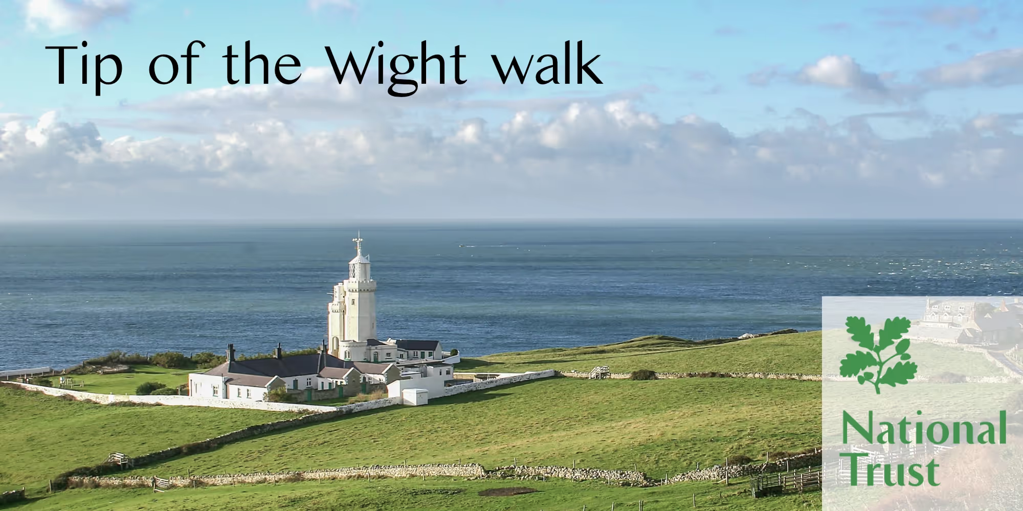
LOOK OUT FOR: St Catherine’s Lighthouse
The present three-tier octagonal lighthouse was completed in 1840, following the shipwreck of the Clarendon in Chale Bay. However, the lighthouse suffered the same fate as the beacon on St Catherine’s Down – its light was often shrouded in mist, so the tower had to be lowered. In 1932 the fog signal had to be moved back from the eroding cliff edge, and was mounted on a small replica tower close to the lighthouse. They are now known locally as the Cow and Calf.
Step 4
Climb up the track. 110yds (100m) after a sharp right bend and just after a bench, turn left up a tarmac path with steps and handrail. Emerge onto a road almost opposite the Buddle Inn. Turn right onto the road for 45yds (40m) before turning left up a tarmac path by the phone box. Follow the path upwards.
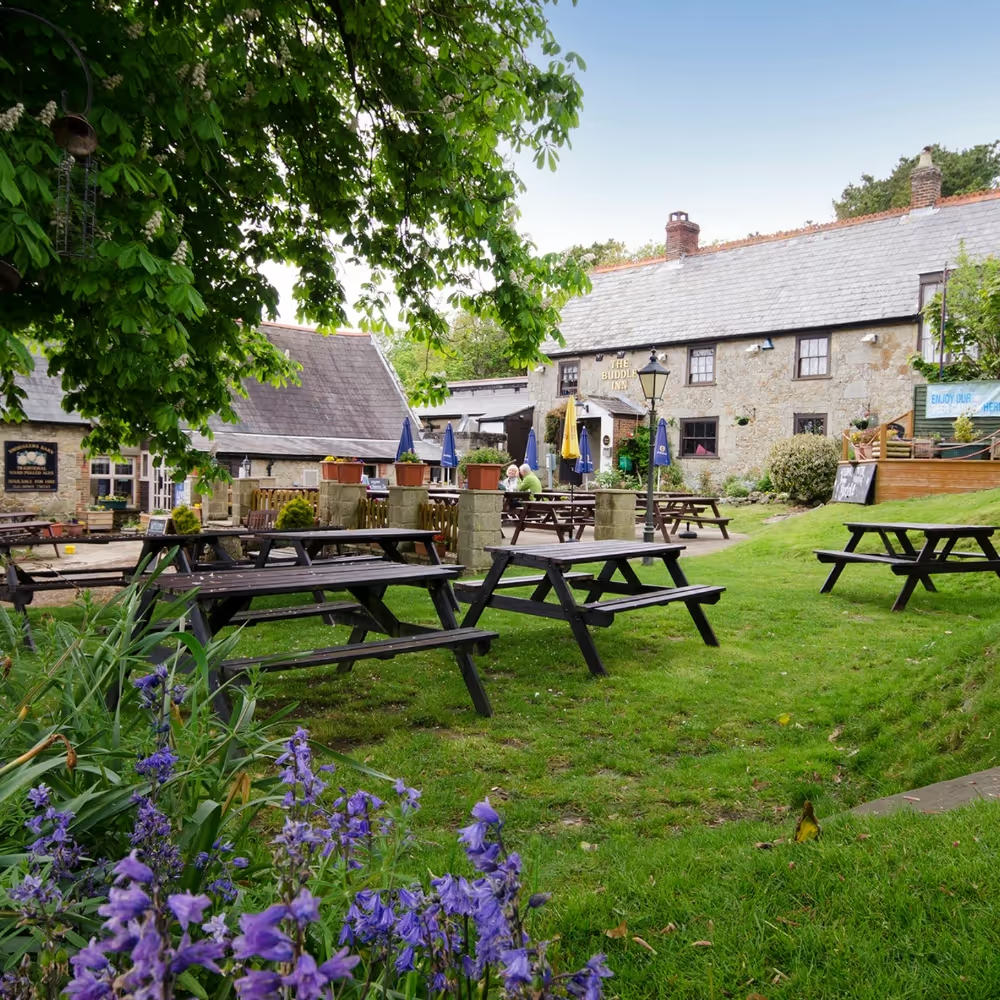
LOOK OUT FOR: The Buddle Inn
The Buddle is a traditional 16th-century smugglers inn, tucked away on the southern tip of the Island. Smuggling was rife in this area, and the inn became a refuge for smugglers, although it was also used by the revenue men. When the smugglers saw a lantern in the window of the inn, they knew the coast was clear and would carry their booty up from the shore and hide it in Niton village.
Step 5
Turn right onto another road (watch out for traffic as there is no pavement) and fork right at a Y-junction at the road’s end. Cross the main road to a grassy area and follow the footpath on its right up Barrack Shute towards Niton village. Just before the crest of the hill take the turn on the left signed Coastal Path. Follow the path gently upwards to a kissing gate. Go straight on and follow the grassy coast path along the top of the cliffs.
LOOK OUT FOR: Wildlife
Look out for peregrines, ravens and fulmars nesting on Gore Cliff above the landslip.
Step 6
Turn left at the marker post just before a seat and descend the steep and sometimes exposed path with steps to the road. There are some tricky sections where the path is narrow and slippery, falling away at the edge, so take extreme care. At the road, turn right and follow it back to the car park.
LOOK OUT FOR: The Landslip
Lots of old postcards of the Undercliff show Windy Corner before and after the landslip of 1928. 20,000 tons of falling rock destroyed the Niton to Chale road and serious landslips continue in this area today. Chalk and greensand rocks crumble away in cliff falls, and massive blocks slip on the lower layer of gault clay, lubricated by ground and rain water. This has given rise to a very varied topography. The whole of St Catherine’s Point is also gradually sliding out to sea on a much deeper layer of Jurassic clay.
End Point
Car park at end of Sandrock Road, Niton Undercliff, grid ref: SZ4947.